LAND, DEEDS, AND MAPS
Atlas of Historical County Boundaries Provided by the Newberry Library.
Cedar County Missouri Deed Search
Deeds and Probate Records Full-Text Search A free account at FamilySearch.org is required.
Land Patents Searchable Government database of original land patents. Copy of original land patents and warrants can be downloaded. Document will state if the land was given as pay for military service or was purchased from the government. Search using Location and Surname - or search by land description to find who the first owner of your ancestor's land was.
1879 Map of Cedar Co. Missouri Missouri Digital Heritage.
Land Records: 1777 - 1969 Missouri Digital Heritage
USGS National Mapping Service Locate a map and aerial photo of any named geographic area (cemeteries, towns, etc.; note that
USGS may have some Cedar County cemeteries listed incorrectly.)
1930 Cedar Co Plat Book University of Missouri Digital Library. Contains plat books of many Missouri counties.
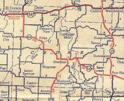
1940 map shows several older communities. Provided by Judy Nichols.
This information is provided for use in your personal family history research. Do not copy this information and publish elsewhere on the internet, post on other websites, or in blogs without the express written consent of the County Coordinator.
Links to web sites that are not part of the USGenWeb Project are provided for your convenience and do not imply any endorsement of the web sites or their content by The USGenWeb Project.
Missouri State GenWeb Coordinator Asst. State Coordinator
site search engine by freefind
© 1996-2025 Cedar Co, MO County Coordinator, N. Carroll, County Coordinator


